
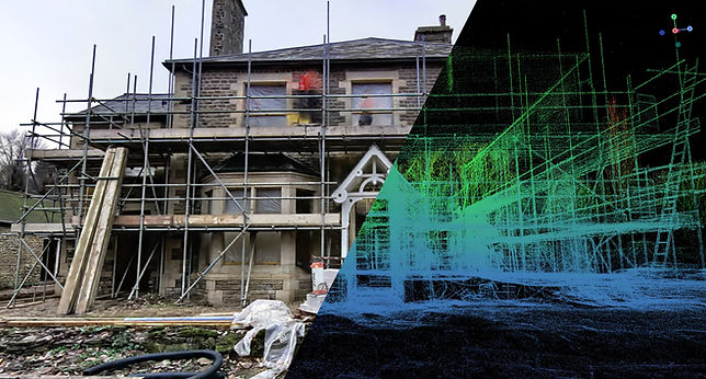
Scanning Surveys
On a fluid and fast-moving construction site, waiting days for a traditional survey can cripple a project’s momentum.
SLAM (Simultaneous Localization and Mapping) scan surveys eliminate this bottleneck by capturing reality at walking speed. Rather than deploying slow, tripod-based equipment that disrupts the site teams, we simply walk through the space with mobile LiDAR scanners. This rapid reality-capture technique functions independently of GPS meaning we can map complex subterranean basements, tightly packed structural corridors, and dark ceiling voids instantly, turning millions of real-time measurements into an accurate 3D point cloud in a fraction of the time.
For HNWIs and executive teams, SLAM surveys provide an agile, high-frequency audit of the build's progress. Because we can scan a site up to ten times faster than traditional methods, we can perform routine checks to overlay the "as-built" physical reality directly onto your architectural plans. If a structural column or a main service pipe has been deviated by even a few centimetres to accommodate site conditions, we catch it immediately. This rapid validation provides the ultimate pre-emptive insurance policy, allowing your executive team to de-risk the project by catching discrepancies long before they impact downstream finishes or inflate physical construction costs.
Industries:
PRIVATE RESIDENTIAL - COMMERCIAL
Expertise Required:
PROJECT MANAGEMENT - MODELLING & MATERIALS - SURVEYING - IDEATION - PRODUCTION - VISUALISATION - PRESENTATION
Video Example - 3DGS
Gallery

